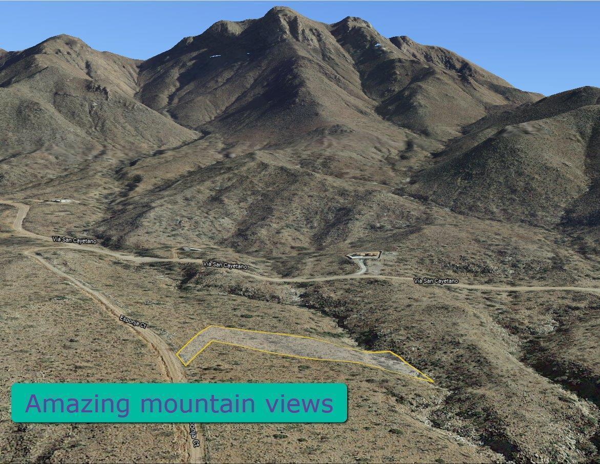
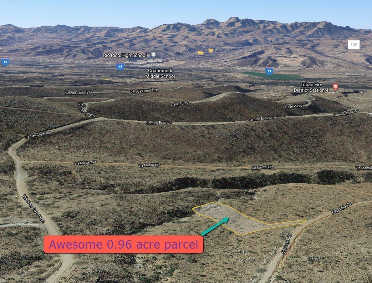
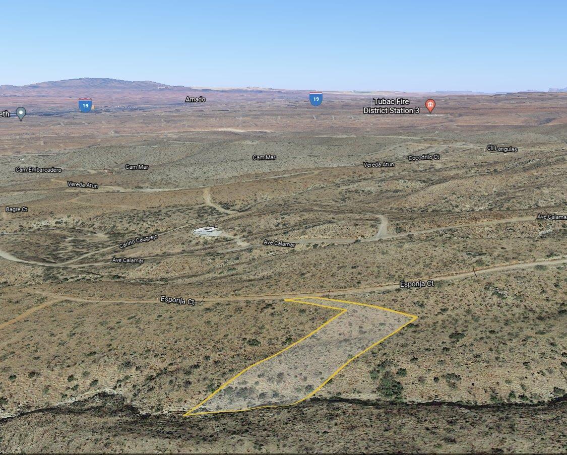
Amazing 0.96 acre parcel East of I-19 in the rolling hills in Rio Rico AZ
Water and power nearby on this lot with amazing mountain views
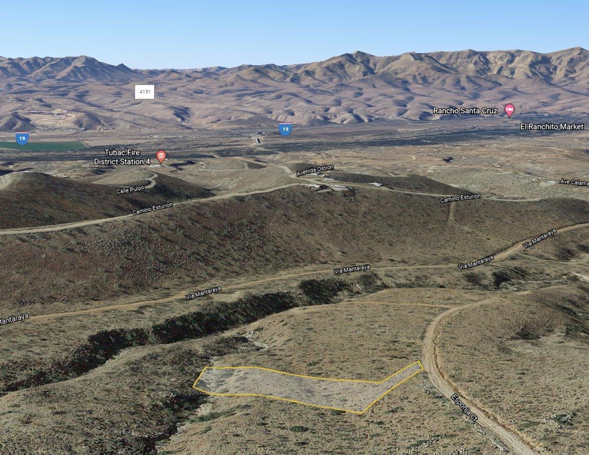
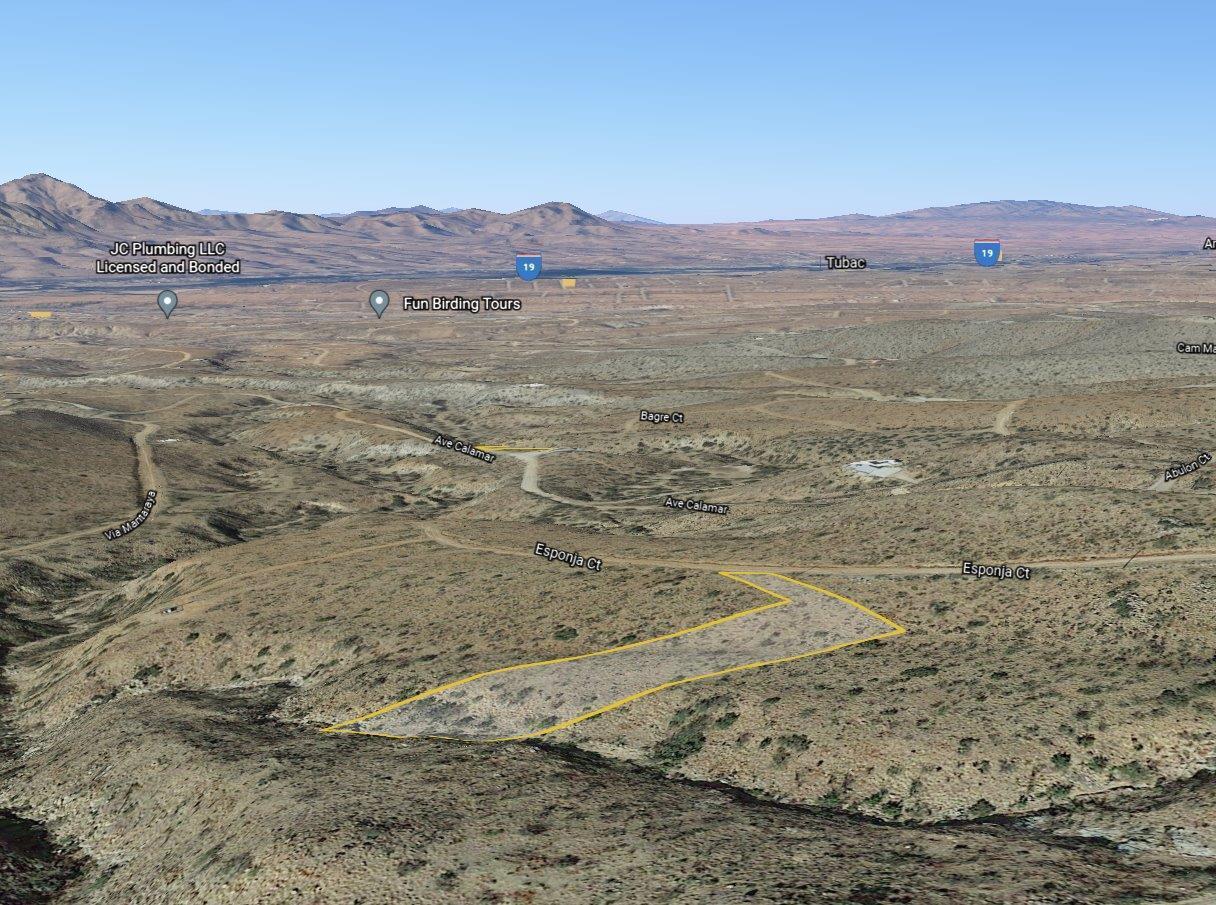
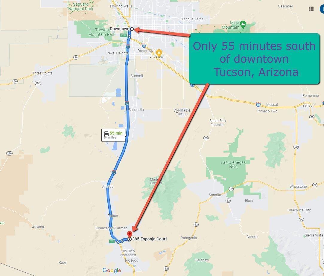
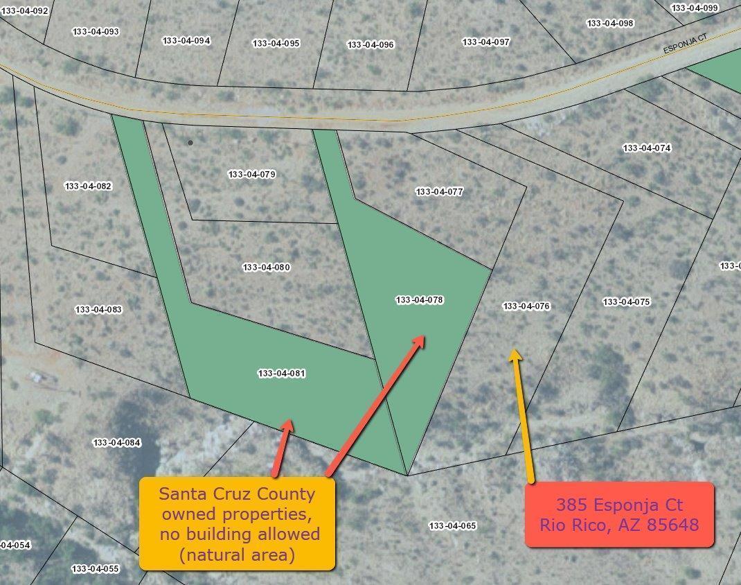
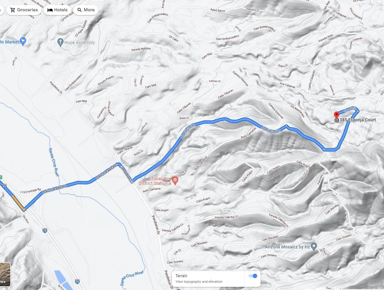
Property Address: 385 Esponja Ct, Rio Rico, AZ 85648
Latitude/Longitude: 31.537905,-110.982416
County: Santa Cruz
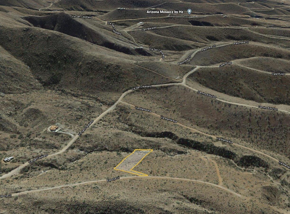
Subdivision: Rio Rico Ranchettes 17
Google Map - https://goo.gl/maps/rjMhX6yNWXY5XwE38
REGrid App - https://app.regrid.com/us/az/santa-cruz/nogales/27751
Directions: Take Exit 17 to Rio Rico Dr. Take exit 17 from I-19 S, Turn left onto Rio Rico Dr, Turn left onto Pendleton Dr, Continue on Avenida Ostion. Drive to Esponja Ct, Turn right onto Avenida Ostion, Turn right onto Camino Esturion, Turn left onto Vía San Cayetano, Turn left onto Esponja Ct, Destination will be on the left
PRICE: $6,000 Plus closing costs
Owner will finance with reasonable down payment. Finance price will include account servicing fee and monthly tax payment. Credit card payments are charged an additional 3%
Santa Cruz County Assessed Land Value $8,200
Permitted uses - Site built homes only
Property Description
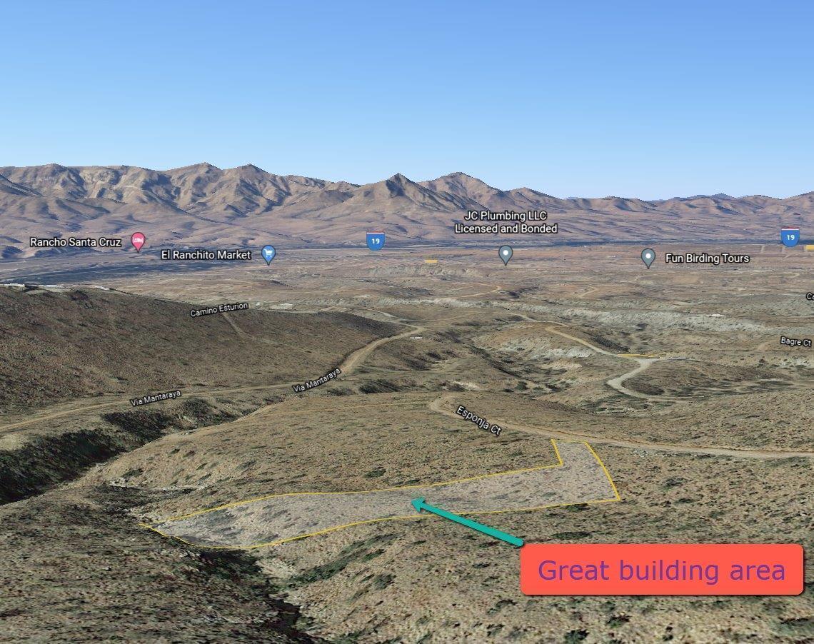
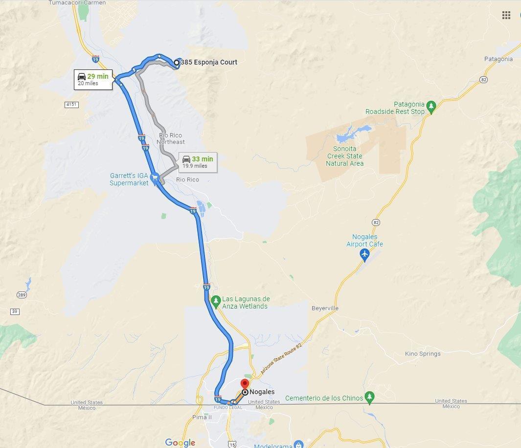
Located in the rolling hills East of Rio Rico with water and power nearby, septic is required. This parcel has county owned property to the west for added privacy, great chance to own your own piece of land (0.96 acre) in Rio Rico, Arizona. Surrounded by endless outdoor activities like playing golf at one the courses in the area, hiking and biking the miles of trails available or just relax and go sightseeing. This property has great mountain views and awesome Sonoran Desert sunsets situated in this quiet rural setting. In nearby Tubac AZ there is shopping, fine dining, museums, art galleries and entertainment for the whole family, Walmart Supercenter is 29 minutes away in Nogales AZ., Tucson is less than 1 hour North with endless amenities available. This is a beautiful buildable lot!
Property Info
Power: Yes - Available
Sewer: Septic Required
Water: Yes - Available (verified)
Gas: Propane Required
Telephone: Unknown
Cable: Unknown
Permits: No
Access: Public Road - Dirt
HOA: No
Violations: No
Survey: No
CCR's: No
Property Details
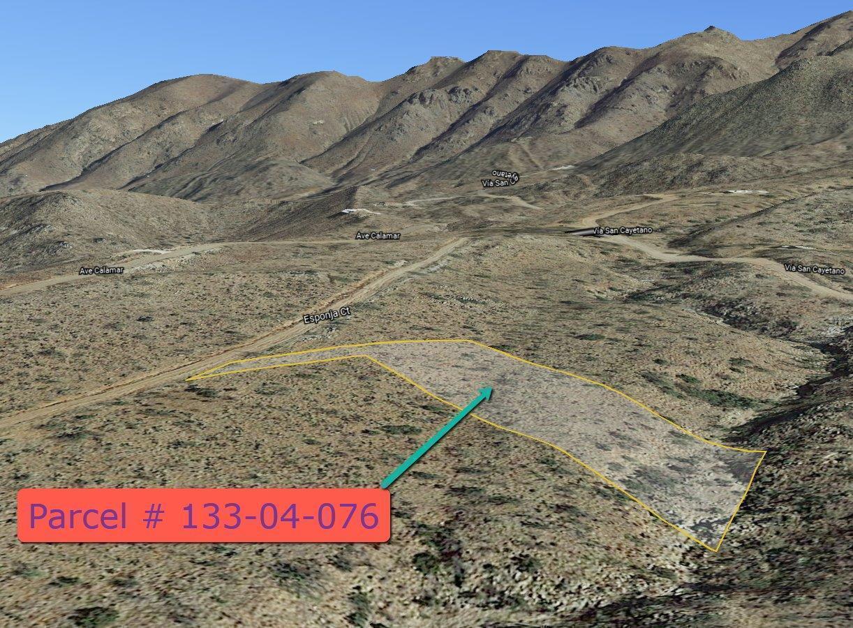
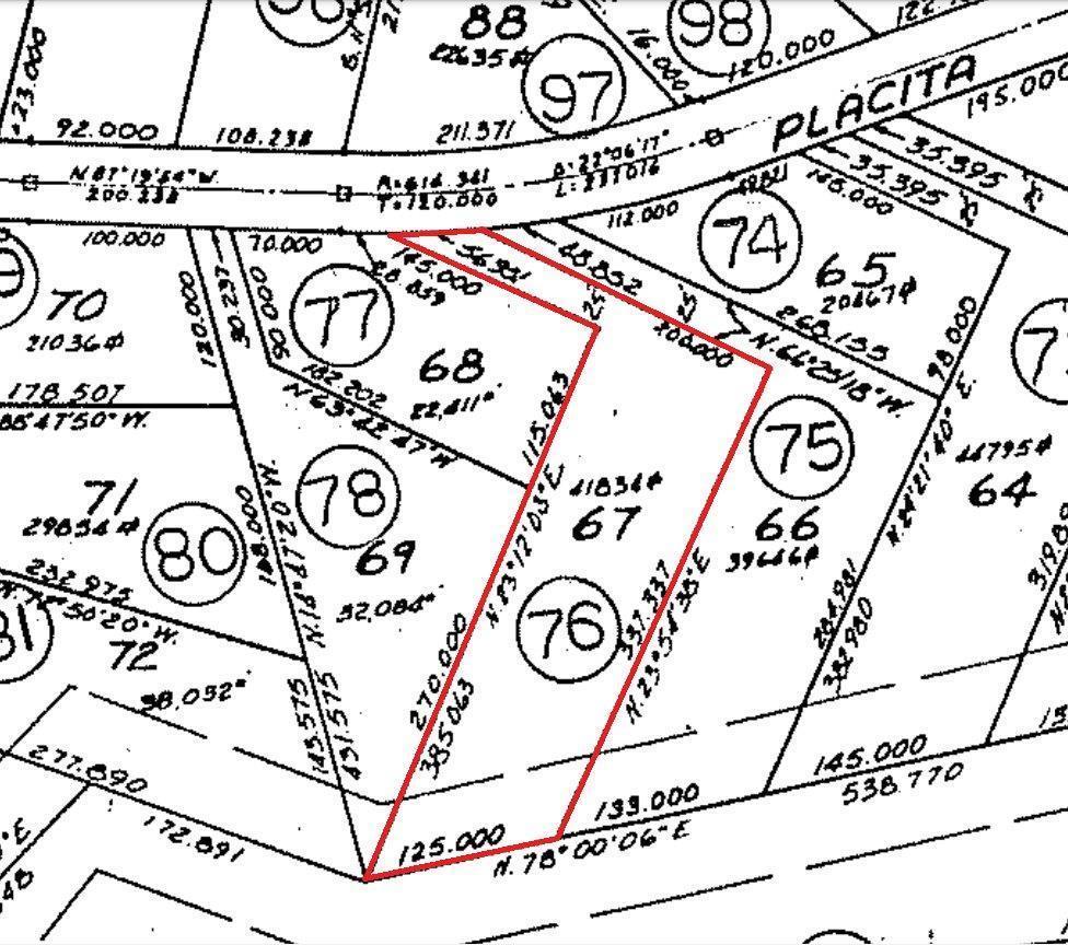
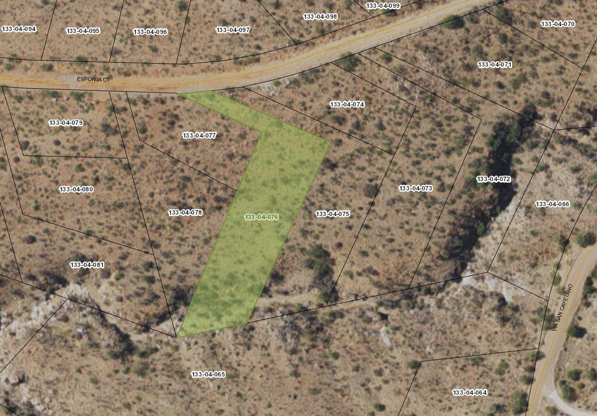
Parcel Number: 133-04-076
Property Type: Residential Vacant Land
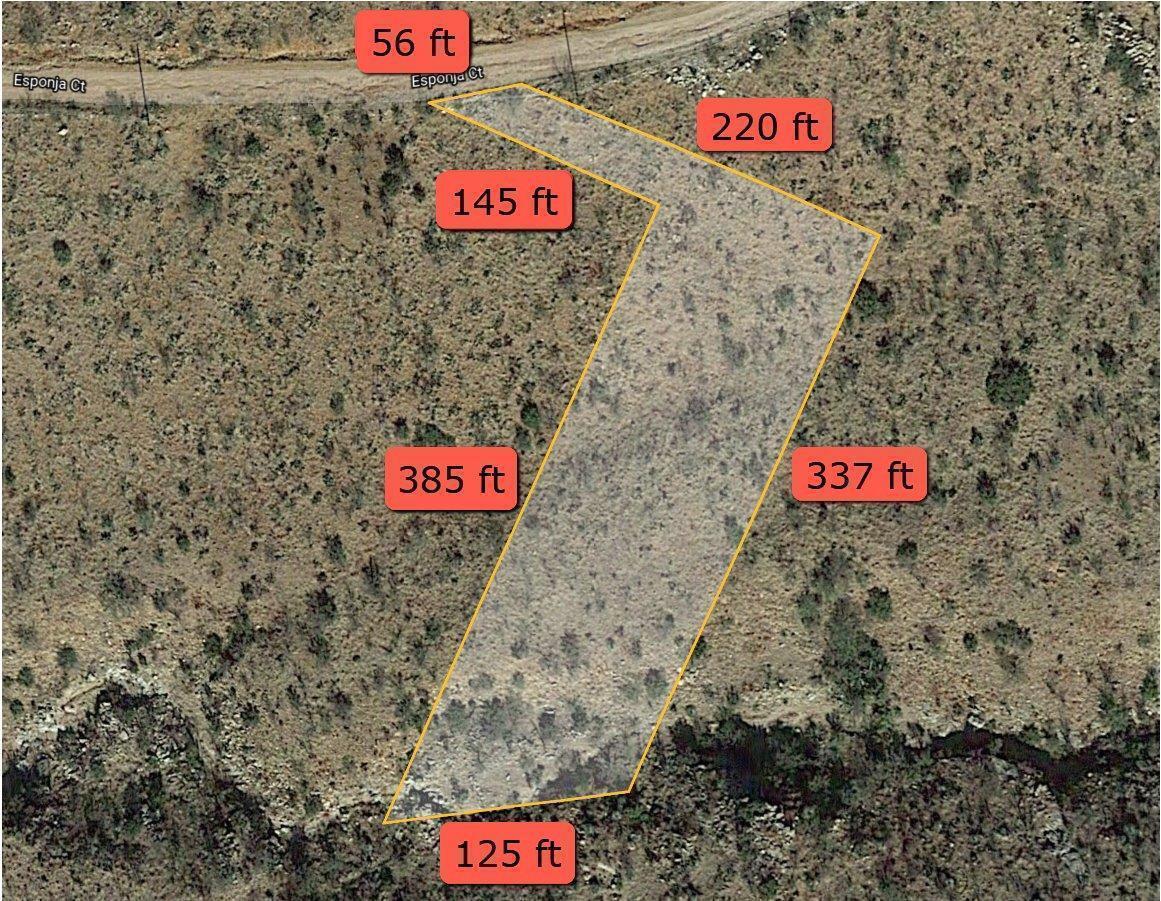
Lot Size: 41,835 sq ft
Acres: 0.96 AC
Topography: Rolling
Dimensions: 56x220x337x125x385x145
Shape: Irregular
Zoned: R2
FEMA Flood Hazard Zone: No
FEMA Floodway: Out
Municipal Flood Zone: No
Yearly Tax Amount: $99.80
Road Type: Dirt
Road Maintenance: County
School District: Santa Cruz Valley United School District #35
Legal: Sub Rio Rico Ranchettes Unit No.17 Lot 67 Of Blk 508
Parcel Details - https://parcelsearch.santacruzcountyaz.gov/santacruzwebpay/ParcelReport?taxid=133-04-076
Treasury Report - https://parcelsearch.santacruzcountyaz.gov/santacruzwebpay/TaxReport?taxid=133-04-076
Photos - https://photos.app.goo.gl/AJZnWvDruru2zPSp6
Video - https://youtu.be/qqge3mXX7JY
Santa Cruz County Community Development 520-375-7930
https://www.santacruzcountyaz.gov/159/Community-Development
Santa Cruz County Zoning and Development Code - https://www.santacruzcountyaz.gov/DocumentCenter/View/8358/Santa-Cruz-County-Zoning-and-Development-Code
Semi-Truck Parking requires M1 - Light Industrial or B2 General with a waiver
Horse Property - R1 & R2 min 3 acres and a conditional use permit required. R3, R4 & R5 (no horses allowed)
All properties are sold AS-IS. Buyer is to pay all closing costs and to do their own independent due diligence.
One or more members of corporation is a licensed real estate agent in the State of Arizona
Map To Property
Property Address:Property Details
- Status: SOLD
- State: AZ
- County: Santa Cruz
- Parcel Number: 133-04-076
- Short Legal Description: Sub Rio Rico Ranchettes Unit No.17 Lot 67 Of Blk 508
- Annual Property Taxes: 95.96
- Size (In Acres): 0.96
Similar properties in the area are listed or have been recently sold for around $8,200.